The Blog
Search
Search
Exhibit
Fresh Photos
Editor's Choice Photos
Photoblogs
Upgrade
PRICING
Login
Start
Your 14-Day Free
Trial
Where you store your photos is as important as the photos you take.
Start Trial Now!
»
N Cal-S Ore 10
N Cal-S Ore 10
7 Shasta-Lava Beds
By SpecialK
;
Mar 10, 2018
108 Photos
Share Album
Justified View
Flow View
Square View
Grid View
Journal View
Highlight View
Large Photo View
Slideshow
Proofing View
TV View
RSS
SpecialK
Gallery
Contact
Menu
N Cal-S Ore 10
N Cal-S Ore 10
7 Shasta-Lava Beds
Mar 10, 2018
108 Photos
Share Album
Justified View
Flow View
Square View
Grid View
Journal View
Highlight View
Large Photo View
Slideshow
Proofing View
TV View
RSS
Gallery
Contact
Menu
×
SpecialK's Gallery
Vacations
N Cal-S Ore 10
7 Shasta-Lava Beds
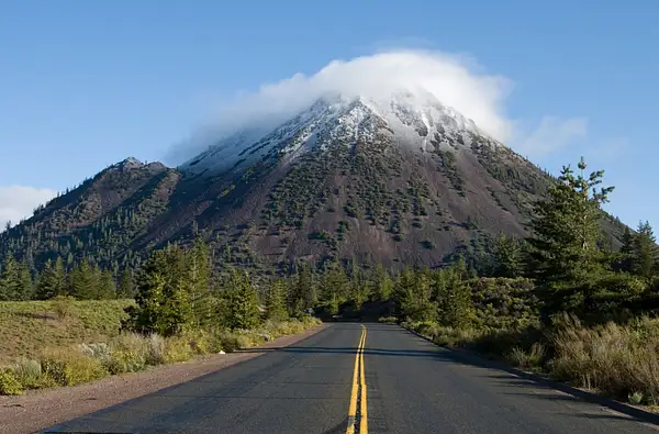
100526-6888ShastaBlackButte
Left
Right
Close
Description:
Tags:
Item information:
Slideshow
?
Close Sidebar
SpecialK
PRO
Follow
Following
Unfollow
Contact
Photo Details
Date
Dimensions
Size
File
Camera
ISO Speed
Exposure
Aperture
Focal Length
Flash
Display Image Quality
Tags
Audio Mute
Prev
Play
Next
Shuffle
Include
Privacy and cookie policy
This site uses cookies to enhance your browsing experience, serve personalized content, and analyze traffic. By continuing to use this site you agree to
use of cookies and stewardship of your data
.
")