7 Shasta-Lava Beds by SpecialK
×
  1. SpecialK's Gallery
  2. Vacations
  3. N Cal-S Ore 10
  4. 7 Shasta-Lava Beds7 Shasta-Lava Beds
1 Lost Hlls-Carm Vly
2 Pacific Grove
3 San Jose - S Fran
4 San Fran
5 Carqnz-Dunsmuir
6 Castle Cr-Mt Shasta
7 Shasta-Lava Beds
8 Ft Klm-Crtr L-Umpq
9 Coql-Honeydew
10 Ukiah-Golden Gt
11 H Castle-Morro Bay
12 L Cach-LA Nat Cem
Black Butte near the town of Mt. Shasta.
The north side of Mt. Shasta.
View point signs.
View point signs.
Last of Shasta.
Passing through Tulelake. This was a Japanese interment center in WWII.
Camp Tulelake sign.
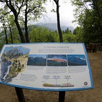
The north end of the Lava Beds National Monument features the remains of Gillem's Camp, used by the cavalry, during the Modoc Indian war. The trail, which I did not take, goes up to the left.
This ceremonial cemetery holds no one buried in it.
Sonchin Butte is the highest point in the area, closed for road work.
The visitor center/museum.
Catacombs cave entrance.
Some of these caves are quite long, and dark, and should not be explored alone.
You can rent a hard hat and flashlight at the visitor center.
Fern at Mushpot cave entrance.
Mushpot entrance.
Mushpot is the only cave with lighting installed, and illuminated displays.
On Bunchgrass Trail.
View from Skull cave of lava and Sonchin Butte.
Rainbow clouds.
Rainbow clouds.
Spatter cone sign.
Fleener Chimneys sign.
One of the chimneys.
View from Fleener Chimney's
Path at Fleener Chimneys.
Scroll To Top

Audio Mute
Prev
Play
Next
Shuffle
Include
Privacy and cookie policy
This site uses cookies to enhance your browsing experience, serve personalized content, and analyze traffic. By continuing to use this site you agree to use of cookies and stewardship of your data.